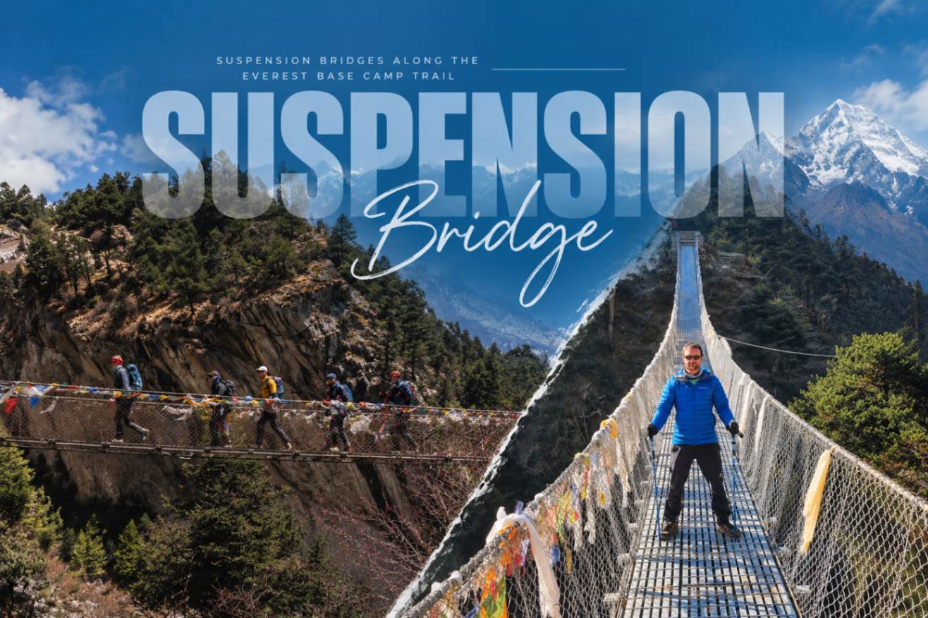
Suspension Bridges Along the Everest Base Camp Trail
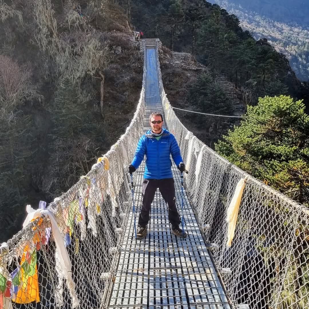
The Everest Base Camp trail crosses the Dudh Koshi and Imja Khola rivers more than a dozen times, and every one of those crossings happens on a swaying steel-cable suspension bridge, strung with prayer flags, often 100 meters or more above the water.
These bridges are not a side detail of the trek in a valley this steep and this cut through by glacial rivers; they are the only reason the trail exists as a continuous route at all.
In this guide we have covered every major suspension bridge from Lukla to Dingboche in details, including the ones lower-profile guides skip, the real history behind the famous Hillary Bridge (including the older, decommissioned bridge still visible beside it), a bonus crossing on the Gokyo side route, and the specific etiquette that keeps foot traffic, porters, and yak trains moving safely across a bridge deck that’s rarely more than a meter wide.
Why the EBC Trail Has So Many Suspension Bridges
The Khumbu region’s rivers, the Dudh Koshi and its tributary the Imja Khola, run through steep, narrow gorges fed by glacial meltwater from the Khumbu and Ngozumpa glaciers.
There is no way to route a trail up this valley in a straight line without repeatedly crossing from one bank to the other as the terrain forces the path back and forth.
Before steel-cable suspension bridges became standard, river crossings in this region relied on wooden log bridges and seasonal fords, both of which were unreliable during the monsoon and dangerous during glacial melt surges.
Many of the modern steel bridges in the Khumbu were built or upgraded with support from the Himalayan Trust, the organization Sir Edmund Hillary founded after his 1953 Everest summit to fund schools, hospitals, and infrastructure for Sherpa communities, along with Swiss-funded development projects; locals and guides
sometimes still refer to the bridge near Monjo as the “Swiss bridge” for this reason.
Without this bridge network, the standard 12 to 14 day Everest Base Camp itinerary would require several additional days of detours around river gorges.
Ghat and Toc Toc Bridges: The First Crossings After Lukla
Leaving Lukla, the trail descends toward the Dudh Koshi valley floor, and the first river crossings come quickly, near the small settlements of Ghat and Toc Toc (sometimes spelled Tok-Tok).
These bridges sit at a lower, gentler elevation than anything further up the valley and see far less foot traffic discussion in trekking write-ups than the Hillary Bridge, despite being just as functional a part of the route.
They are a good place to get comfortable with the sensation of a suspension bridge’s mild sway, a stable steel-mesh deck before the trail’s more dramatic crossings later on.
Cheplung and Thado Koshi Bridges
Continuing from Ghat, trekkers reach Cheplung, generally considered the first “named” bridge most itineraries call out, and shortly after, the Thado Koshi bridge.
Both cross tributary streams and side channels of the Dudh Koshi system rather than the main river itself, and both are low, short spans that ease trekkers into the rhythm of the trail: descend, cross, climb, repeat.
Prayer flags line both bridges, a constant visual thread through the entire lower Khumbu section of the route.
Phakding Suspension Bridge
Elevation: ~2,610 m (8,563 ft)
Phakding sits lower than Lukla, meaning the trail actually descends before the real climbing begins, largely to drop down and cross the Dudh Koshi gorge at this point. The Phakding bridge is a standard steel-cable design capable of carrying loaded yaks and mule trains, not just foot traffic, which is typical of nearly every bridge from here through Namche Bazaar. The current below runs fast and visibly cold, fed directly by glacial melt further up the valley.
Bengkar Suspension Bridge
Elevation: ~2,652 m (8,700 ft)
Between Phakding and Monjo, the valley narrows and the Bengkar crossing feels noticeably higher and more exposed than the bridges before it. This stretch of trail is quieter than the busier sections near Lukla and Namche, and it’s often where trekkers first sense they’ve left the more touristed lower valley behind.
Monjo and Jorsalle Bridges: Entering Sagarmatha National Park
Elevation: ~2,835 m (9,301 ft)
The Monjo bridge marks a genuine threshold: just beyond it sits the entry checkpoint for Sagarmatha National Park, a UNESCO World Heritage Site covering 1,148 square kilometers of the Khumbu.
Shortly after, the Jorsalle bridge crosses near the confluence zone where the Bhote Koshi, flowing down from the Tibet border, meets the Dudh Koshi, one of the clearest points on the trail to see two glacially-fed rivers merge into one.
From Jorsalle, the trail begins its long climb toward Namche Bazaar.
The Hillary Suspension Bridge: The Icon of the Trail
Elevation: ~2,860 m (9,383 ft) | Location: Larja Dovan, between Jorsalle and Namche Bazaar | Length: ~60 m (197 ft) | Height above the river: ~135 m (443 ft)
The Hillary Suspension Bridge, officially the Larja Dovan bridge, is the single most photographed structure on the Everest Base Camp trail and, by most measurements, the highest and longest bridge in the Everest region.
It is named informally for Sir Edmund Hillary, who summited Everest with Tenzing Norgay on 29 May 1953 and later spent decades funding infrastructure across the Khumbu through the Himalayan Trust.
The current bridge crosses the Dudh Koshi at a height that makes the river below audible only as a distant roar, and the crossing is typically the last major bridge before the steep, sustained climb into Namche Bazaar.
-
Old Bridge vs. New Bridge
Look down and slightly to the side while crossing, and you will spot the original, lower Hillary Bridge still standing beneath the current one, decommissioned, closed to foot traffic, and left in place as a visible marker of how much the trail’s infrastructure has been upgraded.
Accounts of exactly when the current higher bridge was built vary by source, generally placing construction sometime between the early 2000s and 2013, replacing or supplementing a structure that dated back to broader trail improvements in the 1970s.
Whichever exact year is correct, the practical point for trekkers is straightforward: only use the upper, currently maintained bridge; the lower one is retired and not safe to cross.
-
A Film Location Guides Point Out
Several trekking guides and returning trekkers describe this as the bridge featured in the 2015 film Everest, dramatizing the 1996 Everest disaster, worth mentioning if you want a specific detail to look for, though it is the kind of trail trivia worth treating as guide lore rather than a verified production credit.
Phunki Tenga Suspension Bridge
Elevation: ~3,250 m (10,663 ft)
Above Namche Bazaar, the trail’s character shifts entirely, then drops back down to cross the Dudh Koshi one more time at Phunki Tenga, the trek’s lowest point north of Lukla. This crossing is calmer and far less photographed than the Hillary Bridge, set among juniper and pine forest, and marks the start of the steep climb up to Tengboche Monastery, the largest and most significant monastery in the Everest region.
Pangboche (Imja Khola) Suspension Bridge
Elevation: ~3,985 m (13,074 ft)
Past Tengboche and Deboche, the trail crosses the Imja Khola on the way to Pangboche, home to the highest year-round Sherpa settlement in the valley.
By this point, the forest has thinned out almost entirely, replaced by open, rocky terrain, and crossing at nearly 4,000 m feels physically different; breathing is noticeably harder, and Ama Dablam comes into clear view from the bridge itself.
The Bridge Before Dingboche and Pheriche
Elevation: roughly 4,240–4,410 m (13,910–14,470 ft)
Depending on which of the two parallel routes you take out of Pangboche the direct trail toward Dingboche, or the slightly longer alternate through Pheriche you will cross one more bridge over the Khumbu Khola, near where it meets the Imja Khola drainage.
Most standard itineraries take the Dingboche-direct route on the way up and save the Pheriche variant for the descent, meaning many trekkers only cross one of these two bridges on the way in and the other on the way back down.
At this altitude, the landscape is alpine and treeless, with yak pastures and stone-walled fields replacing any remaining forest.
Bonus: The Phortse Bridge on the Gokyo Route
Trekkers extending their trip to include the Gokyo Lakes or the Renjo La / Cho La high passes will cross a bridge over the Dudh Koshi near Phortse, a Sherpa village known for producing a disproportionate number of the region’s high-altitude climbing guides.
This crossing sits off the standard EBC-only route entirely, so trekkers doing the classic out-and-back itinerary won’t see it one more reason the total bridge count on a Himalayan trek depends heavily on exactly which route variant you take.
Bridge Reference Table
| Bridge | Approximate Elevation | Between |
|---|---|---|
| Ghat / Toc Toc | Below Lukla, above Phakding | Lukla and Phakding |
| Cheplung / Thado Koshi | Below Lukla, above Phakding | Lukla and Phakding |
| Phakding | ~2,610 m (8,563 ft) | Ghat and Bengkar |
| Bengkar | ~2,652 m (8,700 ft) | Phakding and Monjo |
| Monjo | ~2,835 m (9,301 ft) | Bengkar and Jorsalle |
| Jorsalle | ~2,835 m (9,301 ft) | Monjo and Namche climb |
| Hillary Bridge (Larja Dovan) | ~2,860 m (9,383 ft) | Jorsalle and Namche Bazaar |
| Phunki Tenga | ~3,250 m (10,663 ft) | Namche and Tengboche |
| Pangboche (Imja Khola) | ~3,985 m (13,074 ft) | Tengboche and Pangboche |
| Dingboche/Pheriche (Khumbu Khola) | ~4,240–4,410 m (13,910–14,470 ft) | Pangboche and Dingboche/Pheriche |
| Phortse (Gokyo route only) | ~3,840 m (12,600 ft) | Namche area and Phortse/Dole |
Bridge Etiquette and Safety Tips
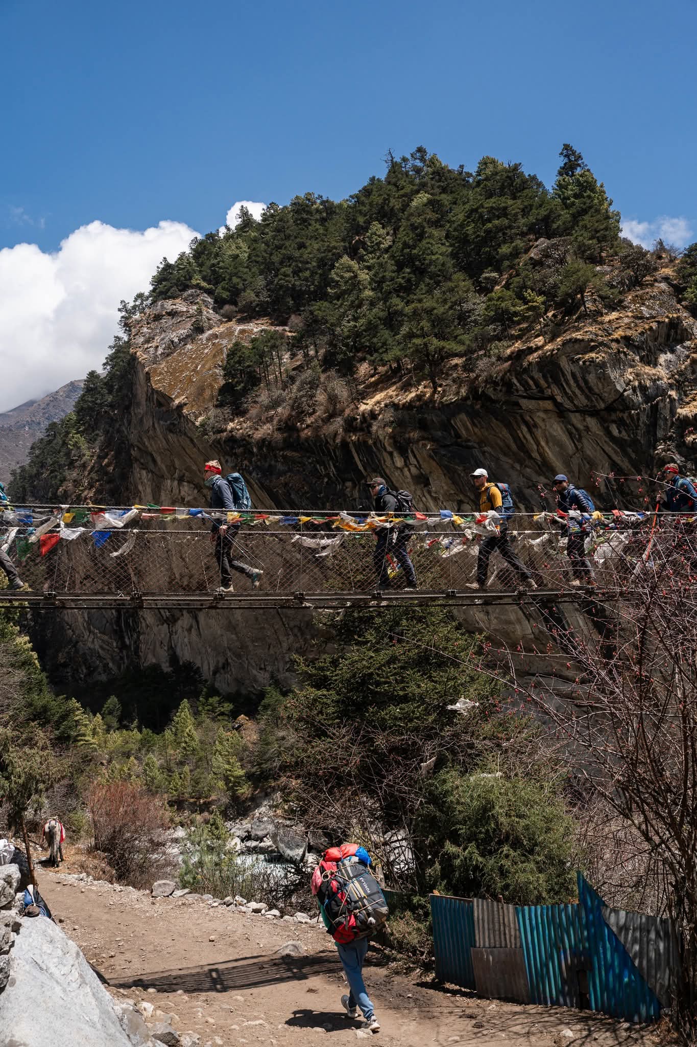
Yaks, mules, and porters use these bridges daily, not just trekkers, and crossing traffic is effectively one-directional at any given moment.
- Always yield to loaded animals. Step to the mountain (uphill) side of the trail and wait for yak or mule trains to fully clear the bridge before starting your own crossing.
- Don’t rush. The steel-mesh decking is uneven in places, and crossing slowly is safer than trying to keep pace with a faster hiker ahead of you.
- Skip the trekking poles on the bridge itself. Pole tips can catch in the gaps of the metal mesh decking, which is more likely to unbalance you than help.
- Hold the side cables in windy conditions. Higher bridges like the Hillary Bridge catch real wind, and a firm grip on the railing cable matters more than usual up there.
- Leave the prayer flags alone. They’re placed and maintained by local communities as an active part of Buddhist practice, not decoration for trekkers to take as souvenirs.
- Keep your Sagarmatha National Park permit accessible; it is checked at multiple points along this same stretch of trail, often near these exact bridge crossings.
Conclusion
The suspension bridges along the Everest Base Camp trail aren’t just obstacles between teahouses; they are the physical thread connecting Lukla to Everest Base Camp across a valley too steep and too river-cut to walk any other way, built and rebuilt over decades with support from the Himalayan Trust and Swiss development funding.
From the low, easy crossings near Ghat and Toc Toc to the 135-meter drop beneath the Hillary Bridge, each one marks real progress up the valley, right through to the final alpine crossing before Dingboche.
If you are planning a trek through the Khumbu, Igloo Himalaya Treks builds proper time into every itinerary to stop, look down, and actually take in these crossings rather than rushing across them, whether you’re doing the standard Everest Base Camp Trek, extending to Gokyo Lakes to see the Phortse bridge for yourself, or considering Everest Base Camp with Helicopter Return if you’d rather walk in and fly out.
Other recommended Blog
- How to Choose the Best Trekking Company in Nepal (2026)
- Cheap Treks in Nepal Under $1000 (2026): 8 Best Budget Trips
FAQs
How many suspension bridges are on the Everest Base Camp trek?
Counting every named crossing from Lukla through Dingboche, trekkers cross roughly 10 to 12 suspension bridges on the standard route, with one or two additional crossings if extending to Gokyo or taking the Pheriche variant on the return.
What is the most famous suspension bridge on the EBC trail?
The Hillary Suspension Bridge, also called the Larja Dovan bridge, is the most famous, standing about 135 m above the Dudh Koshi River between Jorsalle and Namche Bazaar.
Is the Hillary Bridge the highest suspension bridge in Nepal?
It is one of the highest in the Everest region specifically, though other Nepali suspension bridges including some in the Annapurna region — reach similar or greater heights and lengths.
Are the suspension bridges on the EBC trail safe?
Yes. They are built to carry regular loaded yak and mule traffic in addition to trekkers, and are maintained as essential local infrastructure, not just a trekking attraction.
Why are there two Hillary Bridges?
The lower, older bridge was decommissioned as trail infrastructure was upgraded, and it remains visible beneath the current higher bridge. Only the upper bridge is currently in use and safe to cross.
Should I use trekking poles when crossing a suspension bridge?
It is generally advised not to, since pole tips can catch in the gaps of the steel-mesh decking common on these bridges, which is more likely to cause a stumble than to help with balance.
Do all Everest Base Camp routes cross the same bridges?
No. The Phortse bridge, for example, only appears on itineraries that include the Gokyo Lakes or the Cho La / Renjo La high passes, not the standard out-and-back Everest Base Camp route.
Who built and maintains the suspension bridges on the Everest Base Camp trail?
The suspension bridges in the Khumbu have been built, upgraded, and maintained through a combination of local community efforts and development support over the years. The Himalayan Trust, founded by Sir Edmund Hillary, has played an important role in supporting infrastructure and community development in the Everest region. If you want to learn more about its work in the Khumbu, visit the official Himalayan Trust website.
How many days do I need for an Everest Base Camp Trek?
Most standard Everest Base Camp Trek packages take around 12 to 16 days, including travel time from Kathmandu and acclimatization days in the Khumbu. A longer itinerary allows more time to adjust to the altitude and enjoy places such as Namche Bazaar, Tengboche, and Dingboche without rushing.
Can I combine the Everest Base Camp Trek with Gokyo Lakes?
Yes. Trekkers can combine Everest Base Camp and Gokyo Lakes in a longer itinerary, usually crossing one of the high passes such as Cho La. This route offers a more varied experience, with Gokyo Lakes, high mountain passes, and additional views of Everest and the surrounding peaks. It also takes more time and requires stronger preparation than the standard EBC route.
Is there an Everest Base Camp trek with a helicopter return?
Yes. An Everest Base Camp Trek with Helicopter Return combines a trek to Everest Base Camp with a helicopter flight back toward Kathmandu after reaching the Khumbu. It can be a useful option for travellers who want to experience the classic trekking route while reducing the number of walking days on the return journey.
Is the Everest Base Camp Trek suitable for first-time trekkers?
Yes, the Everest Base Camp Trek can be suitable for first-time trekkers with reasonable fitness and proper preparation. The main challenge is the high altitude rather than technical climbing, so choosing a well-planned Everest Base Camp trekking package with acclimatization days is important. Beginners should also allow enough time for a gradual ascent and follow their guide’s advice throughout the trek.


