
Langtang Flood Today: Rasuwa’s Bhote Koshi Deluge, What Happened, and What It Means for Trekkers
Latest Update August 26, 2026: A major flash flood has struck Nepal’s Rasuwa district, severely affecting areas including Syabrubesi and Timure along the Bhote Koshi River. Authorities have launched search, rescue and relief operations, while downstream communities have been warned to move to safer locations. The full extent of casualties and damage is still being assessed.
The Langtang region is facing a major disruption today, August 26, 2026, after a sudden and powerful flood surged into the Bhote Koshi River from the Tibet side and caused extensive damage in northern Rasuwa.
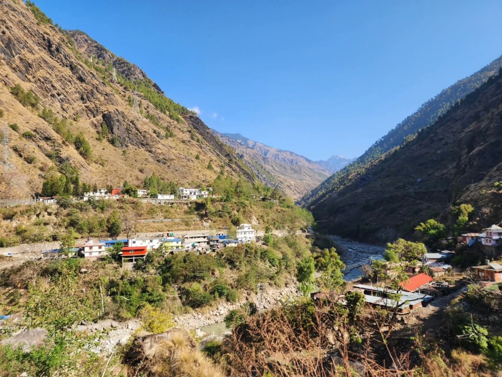
The worst-affected areas reported so far include Syabrubesi and Timure, where floodwaters have damaged settlements, markets, roads and infrastructure projects. The surge has also moved downstream toward the Trishuli River, prompting warnings for communities farther south.
For trekkers, the event is particularly important because Syabrubesi is a major gateway to the Langtang Valley Trek. Anyone planning to travel to Langtang, Gosaikunda or other trekking routes that depend on the affected Rasuwa road network should check the latest local conditions before departure.
This is a developing situation, so casualty figures, road conditions, infrastructure damage and trekking access may change as rescue teams reach more affected areas.
Rasuwa Flood Today: What Happened?
A sudden flash flood entered the Bhote Koshi River in Rasuwa from the Tibet side on Wednesday morning, August 26.
The flood was powerful enough to damage settlements and infrastructure along the river corridor. Government officials said the areas around Syabrubesi and Timure were severely affected, while downstream communities were warned about further rises in river levels.
According to reports, the flood reached the Rasuwa area at around 9:00–9:15 AM, although the precise timing and sequence of the event were still being assessed.
The flood then continued downstream through the Bhote Koshi and toward the Trishuli River. Nepal’s Flood Forecasting Division reported that the flood had reached the Galchhi area of Dhading by Wednesday afternoon, with authorities warning communities farther downstream, including areas toward Muglin.
Initial reports indicate damage to:
- Homes and settlements
- Market areas
- Roads and bridges
- Hydropower and infrastructure project sites
- The Timure customs area
- Other facilities located close to the river
The exact scale of destruction is still being assessed.
Where Did the Rasuwa Flood Come From?
The flood did not appear to originate from ordinary rainfall within the immediate Rasuwa area.
Officials reported that the sudden surge entered Nepal from the Tibet side, while satellite observations indicated significant rainfall on the Tibetan side of the border. The exact mechanism was initially unclear.
Later reporting from Reuters said that the flood was triggered by the draining of a supraglacial lake in Tibet, a type of glacial lake located on or within glacier ice.
A supraglacial-lake drainage event can release a large volume of water very rapidly. When that water enters a confined Himalayan river valley, it can produce a powerful downstream flood wave with little warning.
However, because this is a developing disaster, it is best to describe the supraglacial-lake drainage as the current reported explanation rather than presenting every detail of the hydrological process as finally settled.
Was the Rasuwa Flood Caused by Heavy Rain in Nepal?
Current reports indicate that heavy rainfall in Rasuwa itself does not appear to explain the scale of the flood.
Rasuwa’s chief district officer said there had not been significant rainfall around the district headquarters when the sudden flood occurred. The Flood Forecasting Division also said the flooding did not appear to have been caused by heavy rainfall in Rasuwa itself, while satellite imagery showed significant rainfall on the Tibetan side.
Which Areas Were Hit by the Rasuwa Flood?
Timure
Timure in northern Rasuwa was among the areas severely affected by the sudden flood.
The area contains settlements, infrastructure and the Timure Customs Office, an important point for Nepal-China border trade. Reports indicate significant damage around the area, although authorities were still working to establish the full extent of destruction.
Syabrubesi
Syabrubesi was also severely affected.
This is particularly important for trekkers because Syabrubesi serves as one of the principal gateways to the Langtang trekking region. Damage to the town and surrounding road infrastructure can therefore directly affect access to Langtang, even if sections of the upper trekking trail remain physically intact.
Downstream Along the Trishuli
The flood also travelled downstream through the river system.
Authorities warned communities along the Trishuli River to remain alert and move away from vulnerable riverbank areas. By Wednesday afternoon, the flood had reached the Galchhi area of Dhading, with further downstream areas placed on alert.
What Is Known About Casualties and Missing People?
The exact number of casualties was not yet confirmed at the time of the latest reports.
This is important because several unverified figures have circulated online. Such numbers should not be treated as official unless confirmed by Nepal’s government, security agencies or reliable reporting.
Authorities have reported people being out of contact in affected areas, while security personnel were also among those whose status was being assessed. Search and rescue teams were being mobilised to reach areas cut off by the flood.
The district administration and security agencies were continuing to assess:
- Missing people
- Injuries
- Damaged homes
- Destroyed infrastructure
- Road and bridge conditions
- Hydropower project damage
- Conditions in isolated settlements
As rescue teams reach more locations, the official casualty and damage figures may change.
For readers planning to travel, always rely on the latest official information rather than social-media casualty figures.
Why Does the Rasuwa Flood Matter for Langtang Trekking?
The flood matters directly to trekkers because Syabrubesi is a major access point for the Langtang Valley Trek.
The standard Langtang Valley Trek generally follows:
Kathmandu → Syabrubesi → Lama Hotel → Langtang Village → Kyanjin Gompa → Kyanjin Ri / Tserko Ri
The important correction here is that Timure is not part of the standard Langtang Valley Trek route. Timure is farther north in the Rasuwa border corridor and is associated more closely with the Tamang Heritage and Tibet-border areas.
However, the flood still has major implications for Langtang trekking because Syabrubesi and the road corridor leading into the region have been affected.
Nepal Tourism Board identifies Langtang as one of Nepal’s major trekking regions, with Syabrubesi serving as an important access point.
Is Langtang Valley Trek Open After the Rasuwa Flood?
Trekkers should not assume that the Langtang Valley Trek is operating normally today.
The flood has affected Syabrubesi and the surrounding access corridor, while road and trail conditions are still being assessed.
If you have a Langtang trek scheduled in the immediate future, do not travel toward Rasuwa until you have confirmed the current road and trail conditions with your trekking agency and local authorities.
The status can change as:
- Floodwater recedes
- Roads are inspected
- Bridges are assessed
- Landslide risks are evaluated
- Debris is cleared
- Trekking trails are inspected
- Local authorities issue new safety information
At this stage, the responsible approach is to postpone immediate departures through affected areas until safe access is confirmed, rather than claiming that the entire Langtang trekking trail has been destroyed.
Has the Langtang Valley Trail Been Destroyed?
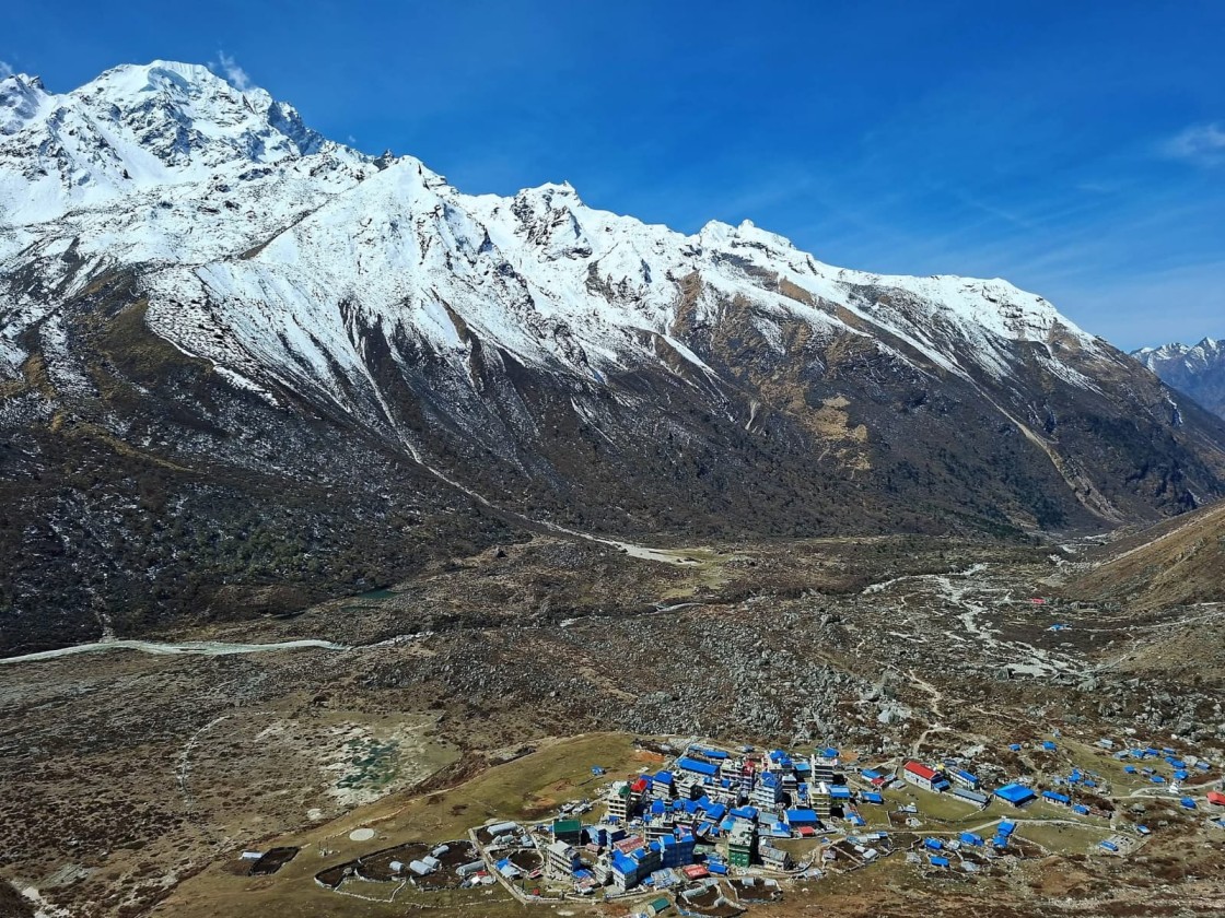
There is currently not enough verified information to say that the entire Langtang Valley trekking trail has been destroyed.
The confirmed concern is the damage around Syabrubesi, Timure and the broader Rasuwa river and road corridor.
The upper Langtang Valley is geographically farther along the trekking route from Syabrubesi, so its condition must be assessed separately.
This distinction matters because a damaged access road or trailhead does not automatically mean every section of the upper Langtang trekking trail has been washed away.
Trekking operators should wait for local assessments before giving clients definitive information about individual trail sections.
What About the Gosaikunda Trek?
The Gosaikunda Trek also requires caution following today’s Rasuwa flood.
Gosaikunda lies within the broader Langtang region, and several trekking itineraries use roads and trails through Rasuwa.
Because roads, settlements and access points in the district have been affected, trekkers planning Gosaikunda should check current access conditions before departure.
This does not mean that every Gosaikunda trail has been destroyed.
Instead, the key issue is whether the particular route being used can be safely reached and whether local authorities have cleared the relevant road and trail sections.
Nepal Tourism Board includes Gosaikunda among the attractions of the Langtang region.
Is Gosaikunda Trek Safe Right Now?
The safest advice for immediate departures is to wait for updated information on the affected Rasuwa access corridors.
If your itinerary starts through a flood-affected area, speak with your trekking agency before travelling.
A responsible trekking company should be able to:
- Check road conditions
- Confirm trail access
- Contact local guides
- Monitor official warnings
- Postpone the itinerary if necessary
- Suggest an alternative trekking destination
Do not attempt to bypass damaged roads, bridges or restricted areas on your own.
Which Roads Are Affected by the Rasuwa Flood?
Authorities have advised against unnecessary travel on several important road corridors because of flood and landslide risks.
These include:
- Galchhi–Nuwakot–Rasuwa–Syabrubesi road
- Risk-prone sections of the Prithvi Highway
- Muglin–Narayangadh road
Authorities have also warned people living near affected rivers and vulnerable areas to move to safer locations.
For trekkers, this means road access should be confirmed before leaving Kathmandu, rather than assuming that a previously normal route remains open after the flood.
Which Areas Are Under Flood Warning?
The immediate concern extends beyond northern Rasuwa because the flood travelled downstream through the Bhote Koshi and Trishuli river systems.
Authorities have urged people living along vulnerable riverbanks to remain alert and move to higher ground where necessary. Warnings have particularly affected communities in Rasuwa, Nuwakot and Dhading, with downstream concerns extending toward the Trishuli corridor.
Because flood conditions can change quickly, travelers should check the latest Department of Hydrology and Meteorology river and flood information before travelling.
What Infrastructure Was Damaged?
The flood has caused damage beyond residential settlements.
Reports indicate impacts on:
- Roads
- Bridges
- Market areas
- Hydropower projects
- Infrastructure construction sites
- Customs infrastructure
- Electricity-related infrastructure
- Other riverbank facilities
Several hydropower projects in Rasuwa were reported to have suffered damage, including the Chilime Hydropower Project.
The scale of damage remains under assessment.
Infrastructure located immediately beside steep Himalayan rivers is particularly vulnerable during sudden flood events because a large surge can carry water, boulders, sediment, trees and debris downstream at high speed.
What Happened to Timure Customs?
The Timure Customs area was among the important infrastructure zones affected by the flood.
Timure is an important point on the Nepal-China border and serves the Rasuwagadhi trade corridor.
Because the flood struck this corridor, the consequences extend beyond tourism. The event has also affected border trade, transportation and infrastructure operations in northern Rasuwa.
Authorities and government agencies were coordinating with the Timure Customs Office as part of the wider search, rescue and response effort.
How Are Authorities Responding?
The Nepal government has mobilised multiple agencies for search, rescue and relief operations.
The response includes:
- Nepal Army
- Armed Police Force
- Nepal Police
- District administration
- National Disaster Risk Reduction and Management Authority
- Medical teams
- Local governments
- Disaster-response agencies
- Rescue helicopters
Two Nepal Army helicopters, accompanied by medical teams, were deployed to affected areas, while private helicopters were also kept on standby.
Authorities have also been working to evacuate people from vulnerable low-lying areas and warn downstream communities.
What Should Trekkers Do Right Now?
If you are planning to trek in Langtang or Gosaikunda in the coming days, take the situation seriously.
If You Have Not Started Your Trek
Before travelling:
- Contact your trekking agency.
- Confirm the current road condition to Rasuwa.
- Check whether Syabrubesi is accessible.
- Confirm the status of the trekking trail.
- Follow local government and security warnings.
- Postpone your trip if access remains unsafe.
- Consider an alternative trekking destination if your travel dates cannot be changed.
If You Are Already in the Region
If you are already near Langtang or Gosaikunda:
- Follow instructions from your guide.
- Stay away from riverbanks.
- Avoid damaged bridges.
- Do not cross flooded sections.
- Avoid landslide-prone slopes.
- Do not attempt unofficial shortcuts.
- Contact your trekking agency.
- Move to higher and safer ground if instructed by authorities.
The biggest mistake after a flash flood is assuming that the water has gone down, therefore the area is safe. Secondary floods, landslides, unstable bridges and debris flows can remain dangerous after the main surge.
What Does This Mean for Upcoming Langtang Treks?
For trekkers with upcoming departures, the situation does not necessarily mean your entire trip must be cancelled permanently.
Instead, your departure should depend on:
- Road reopening
- Bridge inspections
- Trail assessments
- Weather conditions
- Local government instructions
- Availability of accommodation and food supplies
- Communication access
- Advice from local trekking operators
A responsible trekking company should reassess the itinerary before sending clients into an affected region.
If Langtang cannot be accessed safely, postponing the trek or choosing another region is preferable to taking unnecessary risks.
Alternative Treks If Langtang Is Disrupted
If your Langtang or Gosaikunda trek has been affected by today’s flood, Nepal has several other trekking options.
Annapurna Base Camp Trek
The Annapurna Base Camp Trek offers a completely different Himalayan experience, combining traditional mountain villages, rhododendron forests, deep valleys and close views of the Annapurna massif.
It also uses a different geographical corridor from Rasuwa.
Annapurna Circuit Trek
The Annapurna Circuit Trek is another major alternative, crossing diverse landscapes from the lower Marsyangdi Valley to the high-altitude Thorong La region and Mustang.
Current road, weather and trail conditions should still be checked before departure.
Everest Base Camp Trek
The Everest Base Camp Trek follows the Khumbu route and does not depend on the Rasuwa-Syabrubesi corridor.
It can therefore be considered by trekkers whose Langtang plans have been disrupted, subject to current Lukla flights, weather and trail conditions.
Manaslu Circuit Trek
The Manaslu Circuit Trek offers a remote Himalayan experience with high mountain passes and Tibetan-influenced villages.
Road and trail conditions should be checked before booking or departing.
Upper Mustang Trek
Upper Mustang lies in the rain-shadow region of the Himalayas and offers a very different landscape from Langtang.
However, it is still essential to check current road, weather and permit conditions before travelling.
Why Flash Floods Are a Major Risk in the Himalayas
The Rasuwa event also highlights a broader Himalayan hazard: flash floods can occur even when the immediate trekking area is not experiencing heavy rainfall.
Mountain rivers can receive sudden surges from:
- Glacial lake outbursts
- Supraglacial lake drainage
- Ice or rock avalanches
- Landslide-dammed lake failures
- Sudden upstream releases
- Intense rainfall farther upstream
In a steep, narrow Himalayan valley, a sudden increase in water volume can travel rapidly downstream.
This is one reason trekkers should never rely only on the weather immediately around their accommodation or trail location.
What Caused the Rasuwa Flood?
The current reported explanation is that the flood originated on the Tibet side of the border.
Reuters reported that the event was triggered by the draining of a supraglacial lake in Tibet.
Earlier in the day, however, Nepalese officials said the precise cause was still unclear and raised the possibility of an upstream glacial-lake event.
That progression is important.
Because this is a developing disaster, the article should distinguish between:
Confirmed:
A massive flood entered the Bhote Koshi from the Tibet side and severely affected Rasuwa.
Reported explanation:
A supraglacial lake in Tibet drained and triggered the flood.
Still being assessed:
The complete hydrological sequence, exact damage and final casualty figures.
This is the most responsible way to report a developing natural disaster.
How to Check Current Flood Conditions in Nepal
Before travelling to Rasuwa, Langtang or other flood-sensitive regions, check official information rather than relying only on social media.
The Department of Hydrology and Meteorology (DHM) provides river and flood monitoring information and operates flood-related warning services.
DHM currently lists its flood early-warning toll-free service as 1155.
For emergencies, follow instructions from local authorities and Nepal’s security agencies.
Nepal Police: 100
Armed Police Force: 1114
DHM Flood Early Warning: 1155
Emergency numbers and procedures can change, so readers should verify current information with the relevant authorities.
Frequently Asked Questions About the Langtang Flood
Is there a flood in Langtang today?
A major flash flood has affected Rasuwa on August 26, 2026, with severe impacts reported around Syabrubesi and Timure and warnings issued for downstream communities.
What caused the Rasuwa flood today?
Current reporting indicates that the flood originated from the Tibet side. Reuters reported that drainage of a supraglacial lake in Tibet triggered the flood.
Was the Rasuwa flood caused by rain?
The latest information indicates that heavy rainfall in Rasuwa itself does not explain the event. Officials reported that the sudden flood entered from the Tibet side, while significant rainfall was observed on the Tibetan side.
Is Syabrubesi affected by the flood?
Yes. Syabrubesi was among the areas severely affected by the flood, with reports of damage to settlements, market areas and infrastructure.
Is Timure affected by the Rasuwa flood?
Yes. Timure was one of the worst-affected areas, with damage reported around settlements, infrastructure and the customs corridor.
Is Langtang Valley Trek open right now?
Trekkers should not assume that the Langtang Valley Trek is operating normally. Access through the Syabrubesi/Rasuwa corridor has been affected, so upcoming trekkers should confirm current road and trail conditions before travelling.
Has the Langtang trekking trail been completely destroyed?
There is currently insufficient verified information to say that the entire Langtang trekking trail has been destroyed. Confirmed damage has occurred around Syabrubesi and other parts of the Rasuwa corridor, while the condition of individual upper-valley trail sections requires assessment.
Is Gosaikunda Trek affected by the Rasuwa flood?
Gosaikunda trekking can also be affected because some itineraries use the Rasuwa road and trail network. Trekkers should confirm current access conditions before departure.
Is it safe to travel to Rasuwa right now?
Travelers should avoid unnecessary travel through affected river corridors until authorities and local operators confirm that routes are safe. Authorities have specifically urged people to avoid unnecessary travel around affected roads and river areas.
Which areas are under flood warning?
The immediate flood risk extends along the Bhote Koshi and Trishuli river systems. Authorities have urged residents in vulnerable riverbank areas, particularly downstream from Rasuwa, to remain alert and move to safer locations when instructed.
Where can I check official flood updates in Nepal?
The Department of Hydrology and Meteorology provides official river and flood monitoring information. Its website includes a River Watch service and flood early-warning information.
What should I do if I have already booked a Langtang Trek?
Contact your trekking agency before travelling. Ask for an updated assessment of road access, Syabrubesi conditions and the trekking trail. Depending on the situation, your trek may need to be postponed, rerouted or replaced with an alternative destination.
Can I choose another trek instead of Langtang?
Yes. Depending on current conditions elsewhere in Nepal, alternatives can include Annapurna Base Camp, Annapurna Circuit, Everest Base Camp, Manaslu Circuit or Upper Mustang. Current road, weather, permit and trail conditions should be checked for whichever alternative you choose.
Is Langtang Valley Trek Safe After the Rasuwa Flood?
The Langtang Valley Trek is currently affected by the Rasuwa flood, particularly because Syabrubesi, the main gateway to Langtang, has suffered significant damage. Trekkers should postpone immediate departures until road access and trail conditions are assessed and local authorities confirm that the route is safe. For the latest official flood and river conditions, check the Department of Hydrology and Meteorology (DHM)
Final Update for Trekkers
The Rasuwa flood is a serious and rapidly developing event, but travelers should avoid both extremes: do not underestimate the situation, and do not rely on unverified information saying that the entire Langtang region has been destroyed.
The immediate priority is the safety of residents, rescue teams and people already in affected areas.
For trekkers, the best approach is simple:
Do not travel into affected Rasuwa corridors until road and trail conditions have been assessed and safe access is confirmed.
If you already have a Langtang or Gosaikunda trip booked, contact your trekking agency before travelling. Conditions can change rapidly after a major flood, and a professional operator can help you decide whether to postpone, reroute or choose another trekking destination.
At Igloo Himalaya Treks, we monitor trail, road and weather conditions and can help travelers adjust their itinerary according to the latest situation, available time and trekking preferences.
Safety should always come before the itinerary.
Official and Reliable Sources
For readers who want to monitor the situation directly, use authoritative sources:
- Department of Hydrology and Meteorology (DHM): Official river, rainfall and flood monitoring
- Nepal Tourism Board: Official tourism and trekking information
- Nepal Police: Emergency and security information
- National Disaster Risk Reduction and Management Authority (NDRRMA): Disaster-response information
- Local district administration: Current road, evacuation and local safety information


