Igloo Himalaya Treks
Manaslu Region • Sacred Tsum Valley & Larkya La Pass
5.0 reviews on TripAdvisor
5.0 169 reviews on Google

Manaslu Tsum Valley Trek — 20 Days

Combine Tsum Valley’s monastery trails with the Manaslu Circuit on this twenty-day trek. Follow the Budhi Gandaki before entering Tsum to visit Mu Gompa and Ranchen Gompa, then continue through Namrung, Lho and Samagaun towards Larkya La.

Key Trip Facts — Quick Reference

Authentic Client Specification
DURATION 20 Days 20 days, including 17 trekking and hiking days; Day 19 combines walking and driving
DIFFICULTY Challenging Challenging; sustained walking, high altitude and the Larkya La crossing
MAXIMUM ALTITUDE Approximately 5,160 m / 16,929 ft Approximately 5,160 m at Larkya La Pass
DESTINATION Nepal Nepal
ACTIVITY Trekking Trekking
ACCOMMODATION Hotels & Teahouses 2 Kathmandu hotel nights and 17 nights in mountain teahouses or lodges
TRANSPORT Road & Airport Transfers Road transfers to Machha Khola and back from Dharapani; private airport transfers
MEALS All Meals on Trek Kathmandu breakfasts; trekking meals with tea or coffee; seasonal fruit after dinner; Kathmandu farewell dinner
RECOMMENDED SEASON Spring & Autumn Spring (March–May) and autumn (September–November)
TREK STARTS Machha Khola Machha Khola
TREK ENDS Dharapani Dharapani
TREK REGION Manaslu / Tsum / Nubri Manaslu / Tsum Valley / Nubri
PACKAGE START POINT Kathmandu Kathmandu
PACKAGE END POINT Kathmandu Kathmandu

Manaslu Tsum Valley Trek Overview

Our twenty-day Manaslu Tsum Valley Trek combines a journey to Mu Gompa and Ranchen Gompa with the Manaslu Circuit. The section follows Tsum’s village and monastery trails before returning towards the Budhi Gandaki. Continue through Namrung, Lho and Samagaun, then cross Larkya La at approximately 5,160 metres before descending to Bimthang and the lower valley.

After travelling by road to Machha Khola, follow the Budhi Gandaki through Jagat and the Philim area. The route turns towards the Siyar Khola and enters Tsum through Chumling. Higher up, fields, mani walls and chortens accompany the approach to Chhokangparo and Nile. Monasteries form part of daily life here, while local non-violence traditions reflect the relationship between local Buddhist practice, wildlife and the surrounding natural mountain environment.

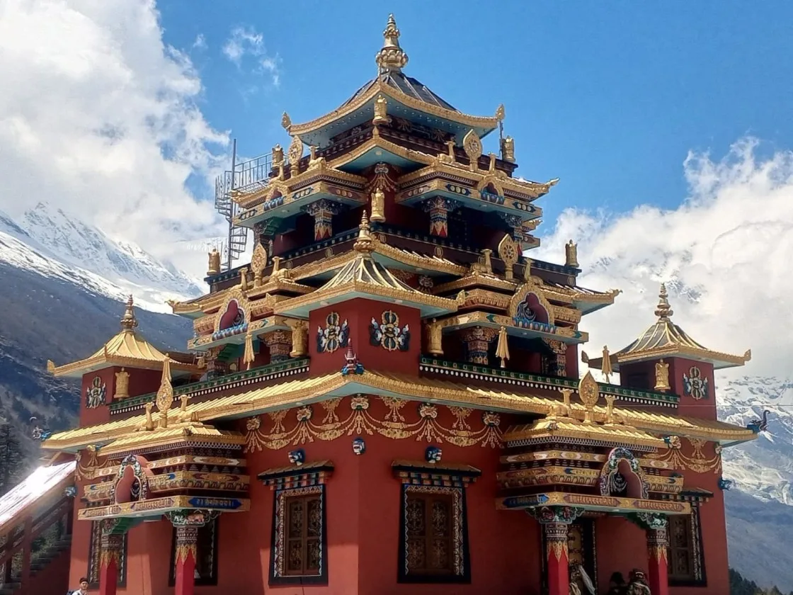
Mu Gompa, around 3,700 metres, marks the upper end of the Tsum section. Descend to Ranchen Gompa before the planned return towards Deng and the main Manaslu trail. Beyond Deng, the route continues through the Nubri area, where Namrung, Lho and Samagaun bring village stays, monastery visits and views towards Manaslu when conditions are clear.

Two nights at Samagaun allow a short acclimatisation walk before continuing to Samdo and Dharmasala. The pass day includes a long ascent over rocky ground and a substantial descent to Bimthang. Forests return on the way to Tilje and Dharapani. Good walking fitness, warm equipment and attention to altitude are important, while the extended Tsum return stage needs advance planning.

You stay in mountain teahouses or lodges during the trek and a Kathmandu hotel. The twenty-day programme covers arrival, monastery trails, the circuit, return road travel and departure.

Manaslu Tsum Valley Trek Highlights

Combine Tsum Valley’s monastery route with the Manaslu Circuit, connecting Mu Gompa and Ranchen Gompa with the villages below Larkya La crossing.
Visit Mu Gompa at around 3,700 metres, with mountain views across the upper Tsum Valley landscape.
Explore Ranchen Gompa and the villages of Chumling, Chhokangparo and Nile, following trails shaped by Buddhist traditions.
Spend two nights in Samagaun, with a short acclimatisation walk before continuing towards Samdo.
Cross Larkya La at approximately 5,160 metres before the long descent towards the pastures around Bimthang.
Follow the Budhi Gandaki and Siyar Khola valleys, finish through forests and villages on the descent towards Tilje and Dharapani.
LOCAL HIMALAYAN OPERATOR

Why Book the Manaslu Tsum Valley Trek with Igloo Himalaya Treks?

We help you prepare in Kathmandu and support the journey through Tsum and Manaslu. This package includes the following arrangements.

Trek Briefing and Gear Check

Before leaving Kathmandu, we explain the programme, check your essential equipment and help with last-minute preparations. You can ask questions about the walking days, accommodation and what to carry.

Guide and Porter Support

A licensed trekking guide leads the route, with one porter shared between two trekkers. The guide explains local places and visiting customs, while the porter carries your agreed main trekking luggage.

Equipment Planning for the Trek

Bring a sleeping bag, down jacket and main luggage bag. We discuss packing before departure and explain any loan or rental options, with equipment arrangements confirmed in your quotation before travel.

Communication When Plans Change

Road access, weather and conditions around Larkya La can affect the programme. Our team discusses route changes, explains available options and confirms extra accommodation or transport costs outside the services agreed beforehand.

Manaslu Tsum Valley Trek Itinerary — Day by Day

Our twenty-day itinerary combines Tsum Valley, the Manaslu Circuit and a short acclimatisation hike in Samagaun. Times are approximate; road access, trail conditions, weather and individual progress can affect the walking schedule and arrangements.

Day 1: Arrival in Kathmandu

Arrival — Approximately 1,400 m — Arrival in Kathmandu

Overnight altitude Approximately 1,400 m
Accommodation 3-star hotel in Kathmandu; room sharing as quoted
Meals Arrival-day meals at your own expense

Welcome to Nepal. Our representative meets you at Tribhuvan International Airport and transfers you to your hotel. After settling in, we discuss the trekking programme, review equipment and check documents needed for the Manaslu and Tsum permits.

Depending on your arrival time, explore nearby streets or rest after your flight. Keep your passport, insurance information and trekking gear ready, and confirm tomorrow’s road transfer before leaving for Machha Khola.

Day 2: Drive from Kathmandu to Machha Khola

Scenic Drive — Approximately 900 m — Approximately 8–10 hours

Driving time Approximately 8–10 hours; road conditions and traffic affect timing
Main activity Road transfer to Machha Khola; vehicle arrangements as quoted
Overnight altitude Approximately 900 m
Accommodation Teahouse or lodge in Machha Khola
Meals Hotel breakfast; travel-day lunch and dinner as quoted

We leave Kathmandu by road and travel towards Machha Khola in Gorkha. Towns, cultivated hillsides and river valleys mark the journey before rougher roads approach the trekking area.

Traffic, repairs and wet road conditions can extend the drive, so keep water, medicines and a warm layer accessible. At Machha Khola, settle into the lodge and organise your daypack for tomorrow’s first walking stage beside the Budhi Gandaki.

Day 3: Trek from Machha Khola to Jagat

Trek Stage — Approximately 1,340 m — Approximately 6–7 hours

Walking time Approximately 6–7 hours
Trail character Riverside paths, stone steps, bridges and repeated climbs
Overnight altitude Approximately 1,340 m
Accommodation Teahouse in Jagat
Meals Breakfast, lunch and dinner

Our journey follows the Budhi Gandaki towards Jagat, passing lower-valley villages and crossing bridges along the river. Stone paths, shorter climbs and uneven stretches make this a full trekking day.

Forested slopes and cultivated areas accompany sections of the route, with local homes and roadside lodges along the river valley. We take the climbs steadily and allow time for breaks. Jagat is an important checkpoint for the Manaslu region. After reaching the village, settle into the teahouse and prepare for tomorrow’s continued walk towards Chisopani.

Day 4: Trek from Jagat to Chisopani

Trek Stage — Approximately 1,660 m — Approximately 4–5 hours

Walking time Approximately 4–5 hours
Trail character Village paths through the Philim area and wooded hillsides
Overnight altitude Approximately 1,660 m
Accommodation Teahouse in Chisopani; exact lodge stop confirmed before departure
Meals Breakfast, lunch and dinner

We continue through the Budhi Gandaki Valley, passing village paths and cultivated slopes towards the Philim area. Bridges link sections of the trail, while forested hills rise above the river and its narrow valley floor.

The route includes climbs and descents before reaching Chisopani, the lower-valley stop named in this programme. Prayer flags and stone buildings add interest around the villages. After arrival, rest at the teahouse and prepare for the following day’s turn towards the Tsum Valley trail.

Day 5: Trek from Chisopani to Chumling

Trek Stage — Approximately 2,386 m — Approximately 6–7 hours

Walking time Approximately 6–7 hours
Trail character Tsum Valley approach through the Lokpa area and Siyar Khola valley
Overnight altitude Approximately 2,386 m
Accommodation Teahouse in Chumling
Meals Breakfast, lunch and dinner

We leave the Budhi Gandaki route and follow the approach towards Tsum Valley through the Lokpa area. Forest paths, river crossings and hillside climbs lead towards Chumling above the Siyar Khola.

The trail can be steep and uneven, so take care on narrow sections and give pack animals room to pass. Chumling introduces the village landscape of Tsum, with Buddhist shrines and stone houses around the walking route. After reaching the teahouse, rest before tomorrow’s climb towards the village of Chhokangparo.

Day 6: Trek from Chumling to Chhokangparo

Trek Stage — Approximately 3,010 m — Approximately 4–6 hours

Walking time Approximately 4–6 hours
Trail character Valley paths and a sustained climb into upper Tsum
Overnight altitude Approximately 3,010 m
Accommodation Teahouse in Chhokangparo
Meals Breakfast, lunch and dinner

We follow the Siyar Khola through village paths and wooded stretches. A sustained climb leads towards Chhokangparo, where fields and houses spread across a broader part of the upper Tsum Valley.

Mani walls, prayer flags and chortens reflect the valley’s Buddhist traditions. Walk around religious structures respectfully and ask before photographing people. Today brings an increase in sleeping height, so report symptoms early. After checking into the teahouse, keep the afternoon gentle before tomorrow’s walk towards Nile and the monastery route.

Day 7: Trek from Chhokangparo to Nile

Trek Stage — Approximately 3,361 m — Approximately 5–6 hours

Walking time Approximately 5–6 hours
Trail character Upper-valley village paths, fields and open slopes
Overnight altitude Approximately 3,361 m
Accommodation Teahouse in Nile or the nearby Chhule area, as arranged
Meals Breakfast, lunch and dinner

We follow the upper valley towards Nile, passing fields, village houses and Buddhist shrines. The route gains height through a more open landscape, with views towards the surrounding mountains when the weather is clear.

Tsum’s villages are known for their Buddhist traditions. Respect customs and give people space around homes and religious sites. After reaching Nile, settle into the lodge and prepare for tomorrow’s walk towards Mu Gompa, the uppermost overnight stop in the Tsum section.

Day 8: Trek from Nile or Chhule to Mu Gompa

Trek Stage — Approximately 3,700 m — Approximately 3–5 hours

Walking time Approximately 3–5 hours; starting lodge and visits affect timing
Main activity Upper-valley walk and monastery visit when open
Overnight altitude Approximately 3,700 m
Accommodation Basic lodge or monastery-area accommodation near Mu Gompa, as arranged
Meals Breakfast, lunch and dinner

Leaving the Nile and Chhule area, we walk higher through open slopes and grazing ground towards Mu Gompa. The mountains become more prominent as the valley broadens beneath the high mountain ridges surrounding the monastery.

Mu Gompa is one of Tsum’s main Buddhist centres. Visiting depends on access and activities, so follow local guidance before entering or taking photographs. Tonight’s accommodation is basic, with fewer facilities than lower villages. Rest afterwards and prepare for tomorrow’s return towards Ranchen Gompa.

Day 9: Trek from Mu Gompa to Ranchen Gompa

Trek Stage — Approximately 3,240 m — Approximately 5–6 hours

Walking time Approximately 5–6 hours
Main activity Descend through upper Tsum and visit Ranchen Gompa when open
Overnight altitude Approximately 3,240 m
Accommodation Basic teahouse or lodge near Ranchen Gompa
Meals Breakfast, lunch and dinner

We descend from Mu Gompa through the upper valley towards Ranchen Gompa, also commonly written Rachen Gompa. Grazing areas, village paths and Buddhist shrines accompany the return, with changing views as we lose height.

The monastery is an important centre for the Tsum community. Follow visiting customs and ask before photography. After the visit, settle into accommodation and prepare for the extended return towards the Manaslu trail, with tomorrow’s route and overnight arrangements confirmed in advance.

Day 10: Trek from Ranchen Gompa to Deng

Trek Stage — Approximately 1,860 m — Extended linking stage

Walking time Extended linking stage; route and timing must be agreed before booking
Trail character Return from Tsum towards the main Manaslu trail
Planned overnight altitude Approximately 1,860 m
Accommodation Teahouse in Deng, subject to the confirmed walking plan
Meals Breakfast, lunch and dinner

The planned route leaves Ranchen Gompa and returns down the Tsum Valley towards the Chumling and Lokpa areas. It then joins the Budhi Gandaki river corridor before continuing north towards Deng on the Manaslu Circuit.

This is an extended linking stage rather than a routine short descent. Confirm the route, walking time and overnight plan before booking. The operating team must assess trail access and the group’s pace; the agreed arrangements determine how the return from Tsum is completed.

Day 11: Trek from Deng to Namrung

Trek Stage — Approximately 2,630 m — Approximately 6–7 hours

Walking time Approximately 6–7 hours
Trail character River crossings, forest paths and a sustained final climb
Overnight altitude Approximately 2,630 m
Accommodation Teahouse in Namrung
Meals Breakfast, lunch and dinner

We follow the Budhi Gandaki through slopes and village paths towards Namrung. River crossings and repeated climbs connect the route, with the final ascent bringing us further into the Manaslu landscape.

Buddhist shrines and carved mani stones become more frequent along the trail. The valley surroundings gradually change as the route enters the Nubri area, which is distinct from the Tsum Valley visited earlier. At Namrung, settle into the teahouse and rest before continuing towards Lho and clearer views of Manaslu.

Day 12: Trek from Namrung to Lho Gham

Trek Stage — Approximately 3,180 m — Approximately 4–6 hours

Walking time Approximately 4–6 hours
Trail character Climbing village trails, fields and forest sections
Overnight altitude Approximately 3,180 m
Accommodation Teahouse in Lho
Meals Breakfast, lunch and dinner

We climb from Namrung through village paths and cultivated ground towards Lho, also named Lho Gham in this itinerary. The route passes Buddhist shrines and wooded sections, with the peaks appearing when the weather allows.

Lho is known for views towards Manaslu and for Ribung Monastery above the village. A visit depends on opening and arrival time. Today gains sleeping height, so take the stretches steadily. At the teahouse, rest before tomorrow’s walk through the Shyala area towards Samagaun.

Day 13: Trek from Lho Gham to Samagaun

Trek Stage — Approximately 3,530 m — Approximately 4–6 hours

Walking time Approximately 4–6 hours
Trail character Forest and open village paths through the Shyala area
Overnight altitude Approximately 3,530 m
Accommodation Teahouse in Samagaun
Meals Breakfast, lunch and dinner

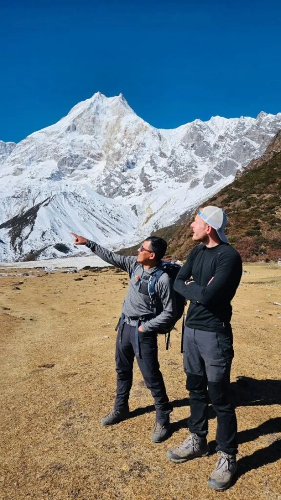
Leaving Lho, we continue through forest and more open ground towards Shyala and Samagaun. Clear weather offers views of the Manaslu mountains, while grazing areas and village paths accompany the walk.

Samagaun is an important overnight stop before the route climbs towards Samdo and Larkya La. Houses, mani walls and Buddhist traditions reflect the culture of Nubri. After checking into the teahouse, keep the afternoon relaxed. We stay for two nights, allowing tomorrow for a short acclimatisation walk and further rest.

Day 14: Acclimatisation Day with a Small Hike

Trek Stage — Depends on the chosen short hike and turnaround — Approximately 2–4 hours

Walking time Approximately 2–4 hours; route and turnaround depend on health and conditions
Main activity Selected short walk around Samagaun; Birendra Lake is one possible direction
Daytime high point Depends on the chosen short hike and turnaround
Overnight altitude Approximately 3,530 m
Accommodation Same teahouse in Samagaun
Meals Breakfast, lunch and dinner

We stay another night in Samagaun and take a short acclimatisation walk. The direction and turnaround depend on health, weather and the group’s progress, with the Birendra Lake area one possible option for exploration.

The purpose is adjustment time and light activity before continuing higher. Return to the same teahouse afterwards, eat well and rest. Discuss any symptoms with the guide and prepare your daypack for tomorrow’s walk towards Samdo, where the valley becomes more open.

Day 15: Trek from Samagaun to Samdo

Trek Stage — Approximately 3,875 m — Approximately 4–5 hours

Walking time Approximately 4–5 hours
Trail character Open upper-valley paths, grazing areas and shorter climbs
Overnight altitude Approximately 3,875 m
Accommodation Teahouse in Samdo
Meals Breakfast, lunch and dinner

We leave Samagaun and continue through the upper valley towards Samdo. Trees become fewer as grazing areas, stony slopes and views of the mountains shape the walk at this higher elevation.

Although the stage is shorter than several earlier days, altitude still makes the walking demanding. Keep a steady pace and report any symptoms promptly. Samdo has basic lodges and a strong Tibetan Buddhist cultural influence. After reaching the teahouse, rest and discuss tomorrow’s climb to Dharmasala before the pass crossing.

Day 16: Trek from Samdo to Dharmasala

Trek Stage — Approximately 4,460 m — Approximately 4–5 hours

Walking time Approximately 4–5 hours
Main activity Climb to the final overnight stop before Larkya La
Overnight altitude Approximately 4,460 m
Accommodation Very basic lodge at Dharmasala or Larkya Phedi; sharing as arranged
Meals Breakfast, lunch and dinner

We continue towards Dharmasala, also known as Larkya Phedi, the final overnight stop before the pass. The walking route climbs across increasingly rocky ground, with open slopes and glacial scenery replacing the lower valley’s forests.

Sleeping height rises, so walk steadily and report how you feel. Facilities at Dharmasala are basic and nights are cold. Keep warm layers, water and your headlamp ready, then rest after dinner before tomorrow’s early departure for Larkya La and the descent to Bimthang.

Day 17: Cross Larkya La Pass and Descend to Bimthang

Trek Stage — Larkya La Pass, approximately 5,160 m — Approximately 8–10 hours

Walking time Approximately 8–10 hours; snow and trail conditions can extend timing
Main activity High pass crossing and a long descent
Highest point Larkya La Pass, approximately 5,160 m
Overnight altitude Bimthang, approximately 3,590 m
Accommodation Teahouse or lodge in Bimthang
Meals Breakfast, lunch and dinner

We start early from Dharmasala and follow the approach towards Larkya La. Altitude makes the ascent demanding, with snow or ice possible on the trail and near the pass.

At approximately 5,160 metres, Larkya La is the highest point of the trek. Clear weather offers views across the surrounding mountains and glaciers. The guide assesses conditions and the group’s progress before continuing towards the descent.

Beyond the pass, descend carefully over steep, uneven ground towards Bimthang. This long day finishes at a lower elevation, with pastureland and mountain lodges below the peaks.

Day 18: Trek from Bimthang to Tilje

Trek Stage — Approximately 2,295 m — Approximately 6–8 hours

Walking time Approximately 6–8 hours
Trail character Long descent through pastures and forest into the Dudh Khola valley
Overnight altitude Approximately 2,295 m
Accommodation Teahouse in Tilje
Meals Breakfast, lunch and dinner

We descend from Bimthang through open grazing ground before entering forest along the lower route. Rhododendron and other trees bring a change from the rocky pass approach, while the Dudh Khola valley leads towards warmer, greener hills and village paths.

The walking still includes uneven stones, steps and climbs between the downhill stretches. Take care when tired after the pass crossing, using poles where helpful. After reaching Tilje, settle into the teahouse and organise your belongings for the walk to Dharapani and road return.

Day 19: Trek to Dharapani and Drive to Kathmandu

Scenic Drive — Approximately 1,400 m — Approximately 2–3 hours

Walking time Approximately 2–3 hours; road access may affect the pickup point
Driving time Full-day road journey, often 8–10 hours via Besisahar; delays are possible
Main activity Walk from Tilje to Dharapani, then return by road
Overnight altitude Approximately 1,400 m
Accommodation 3-star hotel in Kathmandu
Meals Breakfast and trail lunch; Kathmandu farewell dinner

We walk down from Tilje towards Dharapani, where we meet the Annapurna Circuit corridor. After reaching the pickup point, board the vehicle for the road journey to Kathmandu.

The drive continues through the Besisahar area, with timing affected by road conditions and traffic. After reaching your hotel, rest and prepare for international departure. A farewell dinner is included, with its timing arranged around the day’s road journey.

Day 20: Departure from Kathmandu

Departure — Kathmandu (1,400 m / 4,593 ft) — Airport Transfer & Departure

Main activity Departure from Nepal and airport transfer
Meals Breakfast

Your twenty-day Manaslu Tsum Valley Trek ends today. After breakfast, prepare for your onward journey. Depending on your departure time, there may be an opportunity for a final walk near the hotel before leaving Kathmandu.

Our representative accompanies you to Tribhuvan International Airport for your departure.

What’s Included in the Manaslu Tsum Valley Trek

Airport transfers

Pickup and drop-off for your arrival and departure in Kathmandu.

Ground transport

Road transfers from Kathmandu to Machha Khola and from Dharapani to Kathmandu, with vehicle arrangements as quoted.

Accommodation

Two nights in a three-star Kathmandu hotel with breakfast, plus seventeen mountain teahouse or basic lodge nights; room sharing and any upgrades confirmed before departure.

Meals

Kathmandu breakfasts; breakfast, lunch and dinner during trekking, with tea or coffee served alongside meals and seasonal fresh fruit after dinner; return-day meals follow the itinerary and final quotation.

Guide and porter

Licensed trekking guide and one porter shared between two trekkers during trekking.

Permit coverage

Manaslu restricted-area permit, MCAP and ACAP; separate Tsum restricted permit arrangements confirmed in your final quotation.

Safety arrangements

A basic medical kit and safety support accompany the trek, with the team assessing conditions along the walking route.

Route information

A map supplied for the Manaslu and Tsum Valley journey.

Trip certificate

A completion certificate following the end of your programme.

Farewell dinner

A dinner in Kathmandu after the trek, arranged around your return journey.

What’s Not Included in the Manaslu Tsum Valley Trek

International flights and Nepal visa

Airfare to and from Nepal and your visa fee.

Travel insurance

The cost of your policy, covering high-altitude trekking, medical treatment and emergency evacuation expenses.

Emergency evacuation

Helicopter rescue, medical treatment and costs remain your responsibility or that of your insurer.

Personal equipment

Trekking boots, clothing, sleeping bag, down jacket, luggage and other personal items unless your quotation specifies otherwise.

Extra food and drinks

Snacks, desserts, meals, bottled water and drinks beyond the included meals, fruit and tea or coffee.

Other Kathmandu meals

Lunches and dinners apart from the farewell dinner in the programme.

Teahouse services

Hot showers, Wi-Fi and device charging fees.

Guide and porter tips

Gratuities for your trekking team.

Additional accommodation or transport

Extra costs may apply when delays, itinerary changes or personal extensions require services outside the programme.

Manaslu Tsum Valley Trek Dates & Availability

Starting Prices

Prices are in US dollars and represent starting rates. Contact us with your travel dates and group size to confirm availability and your final quotation.

Number of travellers Starting price per person Action
1 person From USD 1,795
2–4 people From USD 1,440
5–9 people From USD 1,395
10–20 people Request a quote
Other group sizes Request a quote
Prices are in US dollars and represent starting rates. Contact us with your travel dates and group size to confirm availability and your final quotation. Ask us about your preferred dates.

Group Departures

If you would like to trek with other travellers, ask about upcoming group departures. We’ll confirm the available dates, permit arrangements and price for your chosen programme.

2026 / 2027
02
OCT

Oct 02 – Oct 21, 2026

AVAILABLE
$1,395 pp
14
OCT

Oct 14 – Nov 02, 2026

AVAILABLE
$1,395 pp

What to Pack for the Manaslu Tsum Valley Trek

Pack layers for warmer walking days, cold mornings and evenings, and changing weather at higher elevations. Keep water, a warm layer, rain protection, medicines and valuables in your daypack. Use your main duffel for the rest of your belongings.

Packed: 0 / 34 Items
0%

Equipment Planning & Luggage Support Equipment Guidance

Use a duffel for your main luggage. The guide checks essential trekking equipment in Kathmandu. Keep your passport, money and electronics in your daypack throughout the journey.

Hiking Gear

Footwear, daypack, trekking poles and trail essentials
0 / 7 Packed
Category Tip: Ensure your boots are broken in thoroughly before your trek to prevent blisters on rocky trails.

Clothing

Moisture-wicking base layers, warm mid-layers and weather protection
0 / 9 Packed
Category Tip: We provide a down jacket for use during this trek; return it afterwards.

Sleeping Equipment

Sleeping bag and personal comfort accessories
0 / 2 Packed
Category Tip: Lodge rooms are unheated; a four-season sleeping bag is provided free of charge for the trek.

Toiletries & Hygiene

Personal hygiene, sun protection, skin care and first aid supplies
0 / 5 Packed
Category Tip: High UV exposure and arid winds in Mustang require frequent application of sunscreen and SPF lip balm.

Electronics

Headlamp, power banks, camera and universal adapters
0 / 4 Packed
Category Tip: Cold temperatures drain batteries faster. Keep your power banks and phones inside your sleeping bag at night.

Documents & Personal Items

Passports, permits, travel insurance, cash and emergency details
0 / 7 Packed
Category Tip: Always carry sufficient cash in Nepali rupees as ATMs are unavailable in upper villages.

Luggage & Daypack Guidance

Use a duffel for your main luggage. The guide checks essential trekking equipment in Kathmandu. Keep your passport, money and electronics in your daypack throughout the journey.

Read Before You Book

Before booking your Manaslu Tsum Valley Trek, consider the long programme, basic mountain facilities and high pass. These details help you prepare and decide whether the twenty-day route matches your walking experience.

0/10 read Click topics below to explore essential briefings

Trek Difficulty and Fitness

This is a challenging trek because of its length, repeated climbs and altitude. Forest paths, stone steps and rocky slopes feature on consecutive days. Larkya La adds a demanding ascent and long descent, while the extended return from Tsum requires an agreed walking plan before departure.

Previous trekking helps. Build endurance for walks on consecutive days, with a daypack, and practise handling sustained uphill and downhill sections before departure.

Begin preparing around two to three months beforehand, allowing longer if you are starting from a low fitness level. Gradually combine regular walks, hill hikes and strength exercises. Practise in the boots you will wear on the trek.

Altitude and Acclimatisation

Two nights at Samagaun provide additional time for a short acclimatisation walk. The route also includes substantial sleeping-height gains in Tsum and before Dharmasala, requiring assessment before continuing higher.

Tell your guide promptly about headaches, nausea, dizziness or unusual fatigue. Do not continue to a higher sleeping altitude while experiencing symptoms of altitude illness. If symptoms worsen despite resting at the same elevation, descent is necessary. Crossing Larkya La must remain secondary to your health.

Medical Conditions and Travel Insurance

Discuss heart conditions, respiratory issues or joint problems with a doctor before booking. Carry an adequate supply of personal prescription medicines, blister supplies, rehydration salts and basic remedies. Keep them in your daypack, not in the duffel carried by a porter.

Comprehensive travel insurance is mandatory. Your policy must cover emergency medical care, high-altitude trekking up to 5,200 m, helicopter evacuation and unexpected itinerary changes. Check altitude limits carefully, as standard leisure travel policies frequently exclude treks above 3,000 m or 4,000 m.

Accommodation and Room Facilities

You stay in local teahouses with twin-bedded rooms, foam mattresses and shared facilities in most villages. Rooms are unheated; the dining room heater provides the main warmth in the evening.

In Tsum Valley, lodges are simpler than those on popular routes. At Mu Gompa, options are very basic, occasionally including simple dorm-style space if private rooms are unavailable. Dharmasala before the pass has basic stone rooms or tents with communal dining.

Single rooms cannot be guaranteed, particularly during peak seasons in small settlements or at Dharmasala. Where single rooms are unavailable, trekkers share with another group member of the same gender.

Food and Dietary Requirements

Meals are prepared from local lodge menus, featuring dal bhat, noodle dishes, soups, potatoes and porridge. Vegetarian options are widely available and often preferable above Namrung, where fresh meat is scarce.

Tsum Valley has a cultural commitment to non-violence; meat is neither produced nor served in much of the valley. Plan for predominantly vegetarian meals while in Tsum.

Inform us of severe allergies or strict dietary requirements when booking. We will advise what lodges can accommodate and what supplemental food you should bring.

Drinking Water

Avoid untreated stream or tap water. Purchase boiled water from lodges, or treat tap water with purification tablets, drops or a reliable filtration system.

Bring at least two reusable water bottles or a hydration bladder with an insulated tube to prevent freezing at higher camps. Avoid relying on single-use plastic bottles, which create litter in fragile mountain valleys.

Guide and Porter Support

A licensed, English-speaking trekking guide accompanies your group throughout the route. The guide oversees pacing, monitors altitude health, manages lodge arrangements and coordinates transport.

Porters carry main duffels (up to 10–12 kg per trekker, typically sharing one porter between two trekkers). Porters walk ahead to ensure luggage arrives at the night's stop. Trekkers carry a daypack with water, warm layers, camera and valuables.

Showers, Charging and Communication

Hot showers (gas or solar) are available in some lower lodges for an additional charge (typically 300–600 NPR). At higher camps, hot water may be provided in a bucket, or unavailable during freezing weather.

Device charging is available in dining rooms for a fee (200–500 NPR per charge or power bank). Charging speeds are slow, and solar systems may fail during overcast weather. Bring a high-capacity power bank and keep electronics warm inside your sleeping bag at night.

Mobile coverage (NTC and Ncell) is patchy and disappears entirely in parts of Tsum Valley and above Samdo. Some lodges offer paid Wi-Fi cards, but connections are slow and intermittent. Prepare for days without reliable digital communication.

Permits and Documents

This combined route requires multiple permits: the Manaslu Restricted Area Permit (RAP), the Tsum Valley Restricted Area Permit (RAP), the Manaslu Conservation Area Project (MCAP) permit, and the Annapurna Conservation Area Project (ACAP) permit for the descent from Dharapani to Besisahar.

Both Manaslu and Tsum Valley are government-designated restricted areas. Regulations require a minimum of two trekkers accompanied by a licensed Nepali guide; independent trekking is prohibited. Igloo arranges all permits in Kathmandu before departure.

Provide a clear passport copy (valid for at least 6 months) and digital passport-sized photographs upon booking to ensure permits are processed promptly.

Road Delays and Extra Time

The drive between Kathmandu and Machha Khola, and the return from Dharapani to Besisahar and Kathmandu, involves unpaved mountain roads subject to landslides, roadworks and slow traffic. Travel times can exceed estimates.

We strongly recommend planning at least one or two buffer days in Kathmandu at the end of the trip before your international flight home to accommodate any unforeseen road or trail delays.

Altitude Profile of the Manaslu Tsum Valley Trek

The Tsum section climbs to Mu Gompa before descending towards Deng. The Manaslu section rises through Samagaun and Samdo to Dharmasala, the highest overnight stop. Larkya La is crossed during the day before descending to Bimthang. The table separates these overnight elevations from daytime visits.

Interactive elevation map showing daily gain and acclimatisation stopping points. Switch units below to convert between metres (m) and feet (ft).

Overnight Altitudes

Elevation Breakdown
Day Overnight Stop Approximate Altitude
1 Kathmandu 1,400 m
2 Machha Khola 900 m
3 Jagat 1,340 m
4 Chisopani 1,660 m
5 Chumling 2,386 m
6 Chhokangparo 3,010 m
7 Nile / Chhule area 3,361 m
8 Mu Gompa area 3,700 m
9 Ranchen Gompa area 3,240 m
10 Deng — planned stop; route confirmation required 1,860 m
11 Namrung 2,630 m
12 Lho 3,180 m
13–14 Samagaun (Acclimatisation Stop) 3,530 m
15 Samdo 3,860 m
16 Dharmasala 4,460 m
17 Bimthang 3,720 m
18 Dharapani 1,860 m
19 Kathmandu 1,400 m
20 Departure No overnight stay

Elevations are approximate and follow the overnight stops in our itinerary.

Higher Places You Visit

Day excursions, high monasteries and pass crossings reaching higher elevations than overnight lodges

Day 8 • Upper Tsum Monastery 3,700 m

Mu Gompa

Around 3,700 m, followed by an overnight stay near the monastery.

Day 14 • Acclimatisation Hike ~4,000 m+

Short Acclimatisation Hike

The direction and turnaround depend on conditions and the group’s health.

Day 16 • Highest Planned Sleep 4,460 m

Dharmasala (Larkya Phedi)

Approximately 4,460 m, the highest overnight stop, before the following morning’s pass departure.

Day 17 • High Himalayan Pass 5,160 m

Larkya La Pass

Approximately 5,160 m, the highest planned point, before descending towards Bimthang.

Acclimatisation & Pace Note: The repeated Samagaun overnight represents an acclimatisation day. You take a short walk, then return to the same village before continuing higher towards the pass.

Weather and Best Time for the Manaslu Tsum Valley Trek

Spring, from March to May, and autumn, from September to November, are generally the main trekking seasons for this trek. Lower valleys and the high pass experience different conditions, with rain, cloud, cold or snowfall still possible, particularly around Dharmasala and Larkya La Pass.

Find out the temperature ranges you will experience along the trail. Toggle between daily variation and monthly averages, and switch units below to convert between Celsius (°C) and Fahrenheit (°F).

Seasonal Weather Conditions

Year-Round Climate Patterns
Season Months What to Expect
Recommended
Spring
March–May Lower forest trails become warmer, with rhododendrons flowering at suitable elevations. March may retain winter snow near Dharmasala and Larkya La. April often brings comfortable walking days, while May can build afternoon cloud. Check the higher route before committing to the pass crossing.
Peak Views
Autumn
September–November Early September can retain monsoon rain and wet access roads. October and November often offer clearer mountain views, with colder nights later in the season. Wind, frost and snowfall remain possible above Samagaun and around Larkya La.
Cold / Quiet
Winter
December–February Cold nights, shorter daylight and snow or ice make the pass more demanding. Lodge availability and the high crossing need local confirmation. Clear weather can occur, but trail conditions may require changes to the route or the planned departure.
Flexible Pacing
Monsoon
June–August, sometimes extending into September Rain affects lower trails and road access, while cloud can hide mountains and route features. Slippery paths, swollen streams, landslides and damaged crossings can interrupt travel. The high pass requires a current assessment; flexibility and reliable local information are essential.

These are seasonal patterns; conditions can vary from year to year and during an individual trek.

How Weather Changes Along the Route

Elevation gradients & trail exposure

Walking beside the Budhi Gandaki can feel warm in sunshine. Conditions become colder in upper Tsum and beyond Samagaun, especially at Dharmasala, before sunrise and around the Larkya La crossing.

During spring and autumn, nights at Dharmasala can fall below freezing. Wind makes exposed ground feel colder, and snow can linger near the pass. Carry warm layers, weather protection and suitable footwear for changing trail conditions throughout the journey.

Carry warm layers, sun protection, and reliable weather protection accessible in your daypack throughout the route.

Which Season Should You Choose?

Optimal timing for trek priorities

Choose spring for warming lower-valley days and flowering forests. Choose autumn, particularly October or November, if mountain visibility is your priority. Both require preparation for cold and snow higher up.

Winter and monsoon need greater flexibility and current route information.

Contact our mountain team to check real-time trail conditions, lodge openings, and road access for your preferred travel window.

Manaslu Tsum Valley Trek Route Map

Follow the complete 20-day expedition path through the Budhi Gandaki gorge, branching deep into Tsum Valley to visit Mu Gompa (3,700 m) and Ranchen Gompa, rejoining the circuit via Namrung and Samagaun, and conquering Larkya La Pass (5,160 m) to Bimthang and Dharapani.

Detailed Route Map of Manaslu Tsum Valley Combined Trek with Elevation Graph
Official Topographic Route • Elevation Profile
Click to Enlarge Map
Standard: 1,200 × 1,583 High-Res Expedition Path: Budhi Gandaki • Tsum Valley (Mu Gompa) • Larkya La (5,160 m)

Best Himalayan Trekking Reviews

4.9 / 5 (128+ Reviews)

Over 15,000 adventure seekers have explored Manaslu & Tsum Valley, Annapurna, Everest, and Manaslu with Igloo Himalaya Treks.

James & Sarah Video Review
5.0 25 October
Liam & Sophie Video Review
5.0 18 October
David & Chloe Video Review
5.0 14 October
Alpine Horizon Team Video Review
5.0 22 October

Video Review

Igloo Himalaya Treks Experience

Manaslu Tsum Valley Trek FAQs

Find clear answers regarding restricted permits, valley trails, high-pass crossings, and acclimatisation for this 20-day Himalayan expedition.

Sanctuary & Circuit Route

Can I do this trek without previous trekking experience?

Previous trekking helps because this programme combines long days, basic facilities and a high pass. Build endurance before departure and discuss your experience with the company. The route needs fitness, preparation for altitude and a realistic walking plan.

How long is the return from Tsum?

The supplied programme links Ranchen Gompa directly with Deng. This is an extended return, and its route, walking time and overnight plan require confirmation. Agree the arrangements before booking, allowing the team to assess access and realistic daily distances.

Are acclimatisation days complete rest days?

Day 14 includes a short walk around Samagaun followed by another night in the village. The direction and turnaround depend on health and conditions. This programme keeps the acclimatisation outing short before tomorrow’s higher stage.

How does this differ from the Tsum Valley Trek?

The Tsum Valley Trek focuses on the valley’s villages and monasteries before returning south. This combined programme also adds the Manaslu Circuit through Namrung, Lho, Samagaun and Samdo, followed by the Larkya La crossing and descent towards Bimthang and Dharapani.

Which permits are needed for this combined trek?

The route needs Manaslu and Tsum restricted-area permits plus conservation-area entry for Manaslu and Annapurna. Igloo’s published inclusions name Manaslu restricted entry, MCAP and ACAP. Confirm the separate Tsum permit coverage and application arrangements before booking.

Do I need to carry my main trekking bag?

One porter is shared between two trekkers and carries main luggage. You carry your daypack with water, layers, medicines and essentials. Confirm the luggage allowance before departure and keep your passport and valuables with you.

Do I need to bring a sleeping bag and down jacket?

Bring your sleeping bag, down jacket and main luggage bag. Any loan or rental arrangement needs confirmation in your quotation. Pack personal boots, clothing, toiletries and electronics, and check equipment suitability for cold nights before leaving Kathmandu.

Can I book as a solo traveller?

A starting rate is published for one person. Send your dates so the company can confirm permit arrangements, guide support and the departure options. Your quotation sets out the services and price for your booking.

What is the highest altitude on this itinerary?

Larkya La is the highest point at approximately 5,160 metres. Dharmasala, around 4,460 metres, is the highest overnight stop before the crossing. Mu Gompa, approximately 3,700 metres, is the highest overnight point within the Tsum section.

Is insurance covering trekking to 5,000 metres sufficient?

A 5,000-metre limit falls below the planned Larkya La height of approximately 5,160 metres. Ask your insurer to cover the full trekking route, emergency helicopter evacuation and necessary medical treatment, including relevant altitude limits, exclusions and assistance procedures.

Does being fit protect me from altitude sickness?

Fitness helps with sustained walking, but it does not prevent altitude illness. Fit and experienced trekkers can also become unwell. Follow the guide’s assessment and report any symptoms promptly, especially during climbs towards upper Tsum, Samdo and Dharmasala.

What should I do if I feel unwell at altitude?

Tell your guide promptly about headaches, nausea, dizziness or unusual fatigue. Do not ascend to a higher sleeping altitude while experiencing symptoms of altitude illness. If symptoms worsen despite rest at the same elevation, descent is necessary.

PLAN YOUR HIMALAYAN EXPEDITION

Book the Manaslu Tsum Valley Trek

Send us your preferred travel dates, group size and questions about the Manaslu Tsum Valley Trek. We’ll check availability, permits, transport and accommodation. Tell us about your walking experience so we can discuss the twenty-day programme, the extended return from Tsum and the preparations needed for crossing Larkya La with your trekking team.

Chat on WhatsApp
100% Guaranteed Departures 2–4 Hr Response Time Certified High-Altitude Sherpa Guides
MORE ADVENTURES

You Might Also Like

If you prefer a shorter circuit, a monastery-focused valley trek or another mountain route, consider these related Igloo trekking packages.

Enquire about your preferred package for current prices and availability.

Book This Trek — From $1,395